by Mike Grundon
Sitting under the summer stars on top of Garrow Tor is a good way to immediately understand what Bodmin Moor truly is.
With a soft and scented summer breeze sifting up through the bracken on its way in from the North Atlantic, I’m sitting in the heart of a relatively populous Cornwall, but surrounded by darkness. Out there in the night is a necklace of distant market towns and villages, shimmering around my horizon, but the moor inside that loose ring is an empty black that’s rustling with wildlife.
A pair of tawny owls hoot and screech to each other in the dark smudge of trees down to the left of my rocky ledge. Small bats, probably common pipistrelles, are flitting at the moths in the open column of air a few feet in front of me. Something is shouldering its way through the bracken about 30 feet below my perch. I can’t tell if it’s a badger or a sheep.
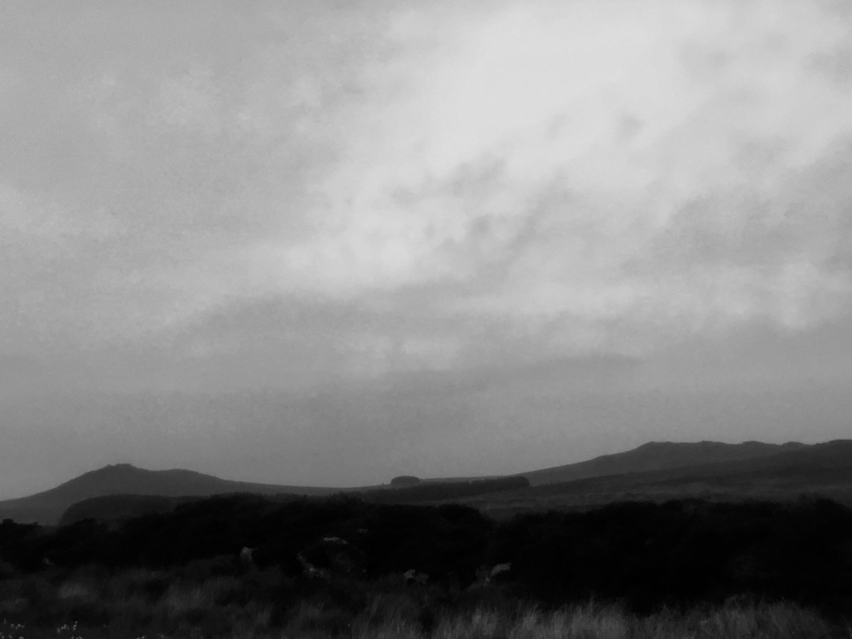
Looking at the Ordnance Survey map, this rugged 100 square mile plateau of granite bulges up out of the surrounding farmland just north of the geographical centre of the county which forms the south-west extremity of Britain. Behind where I’m sitting now looms the highest point in Cornwall, Brown Willy tor, at 1378 feet above sea level. Beside it crouches the silhouette of the second highest ridge, Rough Tor which is correctly pronounced “Rowter”.
From up there on a clear day you can see for 30 miles to the north east, into the county of Devon. This is where Bodmin Moor’s much bigger and more famous neighbour, Dartmoor, wrinkles the distant horizon. Fame and tourist facilities bring 2.5 million visitors to Dartmoor every year. Bodmin Moor is often overlooked. It has no formal attractions so its visitors remain uncounted.
Up on its tors are heaped great, naturally occurring, slabs of granite. Their seams and fault lines have been scoured out over millennia by wind, rain and ice to leave them deeply sculpted into smooth, rounded shapes resembling delicately balanced piles of enormous pancakes or cheeses.

In the bracken and gorse between its hills and crags, there are prehistoric standing stones which long lost communities deliberately planted upright or arranged into loose structures and geometric shapes. They were placed so long ago that their meaning and use are lost to memory and lore. Some are estimated to have been there for over 6000 years.
This habitat is a rare haven for some of the best of British wildlife. Apart from the few public footpaths that ribbon across the landscape, much of the moor is such a tangle of thorns, boulders and bogs that it’s only rarely disturbed by the occasional rough-grazing cattle, horses and sheep that seem to wander the hills at will.
In a few days walking I have watched a pond full of thumbnail sized common frogs squirming out of the water for their first experience of raw sunlight, roe deer browsing on the scrub trees at the rim of a disused quarry, kestrels and buzzards scoping the ground for prey or carrion, a fat female adder hunting through the grass in the full blaze of the day, vivid metallic dragonflies skimming the pools in a moorland stream, a family of foxes playing in the sunset glow through a system of prehistoric field boundaries, and a small cete of badgers truffling under a dead tree for food in the late twilight.
Although great swathes of the moor are devoid of human habitation, that hasn’t always been the case. Utterly empty now and a steep hike from the nearest access road, Rough Tor has the remains of around a hundred prehistoric homes on its flanks. Garrow Tor has almost as many, dating from the Neolithic and Bronze Ages, through to Mediaeval times.
According to Historic England, “the multi-period agricultural and industrial landscape at Garrow Tor survives very well and is recognised as one of the most important archaeological landscapes in Cornwall, which itself is seen as a county that has a particularly rich historic environment”.
The public agency concludes that, “the upstanding remains of dwellings and fields of prehistoric and historic date provide an important insight into the communities that lived and worked here for millennia”.

Despite its relatively diminutive scale, Bodmin Moor is so highly valued by the authorities for its historic remains and natural history that its future appears to be well protected. It’s officially recognised as a Site of Outstanding Natural Beauty, the most important sections of the moor have been designated as Sites of Special Scientific Interest, and farming on the high tops is controlled and governed by commons grazing legislation.
According to local man Alistair Philp, one of the few threats to the area is confusion between various authorities and landowners over the best way to protect the historic sites. Alistair’s grandmother was born and raised in what’s now a deserted cottage in the lee of Garrow Tor. He is one of those who believe that recent attempts to protect the old settlements by fencing them off have led to them becoming overgrown, damaged by plants, and effectively buried from view.
Today, apart from the rough grazing and the low intensity, mixed agriculture around its fringes, there is very little industry that remains on Bodmin Moor. However, it has been exploited in the past.
Granite in various forms has been the main natural resource taken from here. Top quality building stone and ornamental slabs are still hewn in small amounts from the specialist quarry at De Lank. Back in the 1880s blocks were extracted from here to build the famous Eddystone Rock lighthouse and stone was taken to London to build Tower Bridge and the Thames Embankment.
Kaolin, better known as china clay, comes from granite which has decayed so much that it can be pressure hosed from the ground and settled out in ponds. There is a handful of deep, pastel blue lakes associated with almost 150 years of clay extraction dotted around the fringes of the moor but none has been quarried here since 2001.
The clay industry’s lakes and surrounding spoil heaps have been effectively handed back to nature through landscape restoration projects carried out by the mining company Imerys Minerals, formerly English China Clays. The company got help from local councils, the Forestry Commission, English Nature, and the UK Government’s Department for Environment, Food and Rural Affairs. Millions of pounds have had to be spent across Cornwall reshaping and planting redundant spoil heaps because for every tonne of clay there is around nine tonnes of spoil.
Copper and tin were mined in small amounts on the moor in the 1800s, but neither metal was found in commercially viable amounts so the work has left almost no lasting impact on the landscape we see today.
A hike across the northern half of Bodmin Moor in full summer sunlight is an uplifting walk under breezy skies that are trilled with skylarks and scraped by ravens. But when the cloud and mist bank in from the sea, the landscape takes on a dark and mysterious atmosphere. Alongside its substantial substantiated history, this timeless landscape is also home to legend and superstition.

When the chilling tendrils of mist work their way between the rocks and the darkening shadows, my sense of direction is dulled and my sense of position in the landscape fades to memory. It’s then that the deep rock starts to seep old magic.
There are so many standing monoliths, stone circles, quoits, barrows and cairns on Bodmin Moor that it’s possible to get dismissive of all but the most dramatic, but less than a mile from Garrow Tor is an exceptional enigma known as King Arthur’s Hall.
Fifty-six standing stones are arranged inside a rectangular earthwork, aligned lengthways north to south. They surround a patch of cotton grass growing in a boggy plot of ground that is said to stay wet even through the heart of the driest summer. No one knows for sure how old it is nor what it was for. Historic Cornwall says, “many suggestions have been put forward for its origin and function” but, “the date and purpose of the site remain obscure”. Historic England speculates that, “the effort required to both excavate or import material for a bank of such proportions, and to erect the slabs suggest that it had a more important function than just an animal pound.”
Only two other structures similar to King Arthur’s Hall have ever been recorded. One is in Ireland, and the other in Brittany. Whether it or the surrounding King Arthur’s Downs have any tangible connection with the mythical king of the Britons can only be guessed at. The names were first recorded in documents in 1584 but, according to Historic Cornwall, by then the area already had a long tradition of association with Arthurian legend. Speculation that the court of Camelot may have been near this spot is bolstered for some by the fact that the River Camel arcs closely around the north-west perimeter of the moor only a couple of miles from here. It’s also fewer than ten miles from Tintagel.

Local tales speak of melancholy ghosts that drift across the moonlit heath, and a mysterious black cat known as the Beast of Bodmin Moor that’s said to prowl the deep bracken and granite gulleys in search of prey. A display at the Museum of Witchcraft and Magic in nearby Boscastle tells of two elderly women who maintained a pagan shrine on the flank of Rough Tor that was only dismantled when the last of them died just a few decades ago.
It’s an overcast and wet morning as I come down from my night spent sleeping under the vast skies of Bodmin Moor. I’d been tapped awake by the first spots of rain on my face shortly after 6am.
Pushing damp-kneed through the bracken to rejoin the main path at the bottom of the hill, I can understand why some locals have told me that this oasis of wilderness is being protected by its relative obscurity and lack of amenities.
Cornwall is internationally famous for its sandy beaches, dramatic cliffs and picturesque fishing villages, and as an increasing amount of money is invested in improving the transport links to the region, those attractions are getting increasingly busy.
Visit Cornwall says 4.3 million tourists came to stay in the county during the summer and autumn of 2016, but even on a sunny afternoon in the holiday season visitors can still go walking on Bodmin Moor and, beyond the immediate area of a car park, they might only meet around a dozen people.
It seems that as the tide of tourism rises all around it, this quiet granite upland with its untroubled wildlife and prehistoric remains, is still high and dry.

MG.
